The Geospatial Layer for AI
Planetary-scale geospatial infrastructure for spatial intelligence
Where spatial intelligence connects to Earth
TerraLab
The infrastructure layer for spatial AI - where intelligence connects to Earth
The infrastructure layer for spatial AI.
Where intelligence connects to real Earth data.
The Context
AI is learning to understand and interact with the physical world.
But the tools were built for a different era. Geospatial software was designed for humans: slow, read-only, flat 2D projections of a 3D world. Game engines let you build freely but are disconnected from real Earth data.
The world is inherently three-dimensional. Yet most tools flatten it. Nobody built the 3D Earth infrastructure for AI.
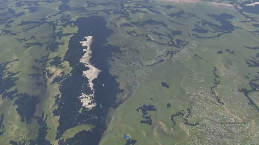
Realtime exploration at any scale
What We Built
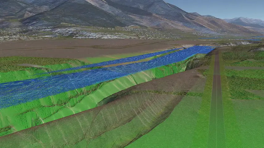
A planetary-scale 3D engine with semantic data orchestration.
Raster, vector, DEM, and 3D meshes unified in a single pipeline. Every element is semantically meaningful—not just pixels on a flat map, but queryable 3D objects with real-world context. Zoom from space to street level. Modify terrain while physics simulations run. 60+ FPS on standard NVIDIA GPUs.
Semantic 3D Architecture
Every node has meaning: terrain, buildings, vehicles. Queryable, serializable, and modifiable through uniform APIs.
Large-Scale Data Pipeline
GPU-optimized orchestration of heterogeneous geospatial data at planetary scale. High throughput for demanding workloads.
AI-Accessible
Making Earth programmable for intelligence.
The entire engine is exposed through APIs, RPC, and protocols like MCP. External systems can connect, read the scene, understand what exists, call functions, modify the world.
Natural language commands that change terrain, spawn objects, run simulations. The middleware between AI and Earth.
LOD/Quadtree Tiles System
The Vision
The infrastructure layer for spatial AI.
Embodied AI. Robotics. Autonomous systems. Simulation environments. All require the same foundation: a true 3D representation of the world that AI can interact with—not flat projections, but volumetric, semantic, physically accurate.
We're building underneath. The layer where agents connect to real geospatial context. Where spatial reasoning meets spatial data at any scale.
Where the 3D physical world becomes programmable for intelligence.
Our Team


20 years in GIS & Digital Transformation
Ex-GIS Team Lead in public sector
Deployed GIS systems for 50+ communes in France
Public sector geospatial transformation

FAQ
Common questions about our spatial AI infrastructure.